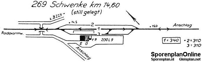
| Betriebsstelle | Schwenke |
|---|---|
| Kürzel | .SWK |
| Typ | Bf |
| Kreis | MK |
| Reichsbahndirektion (1944) | Wpt |
| LochkartenNummer (1944) | 08 434 |
| Bahnhofsklasse | IV OR |
| Gleisplan (c) sporenplan.nl | 1965/69 |
| Karten | GoogleMap NRWbahnarchivKarte OpenStreetMap susudata |
| Geokoordinaten (WGS84) | 7,441031° Ost 51,1888° Nord |
| Landeskoordinaten (GK2) | 2600785m Rechts 5673639m Hoch |
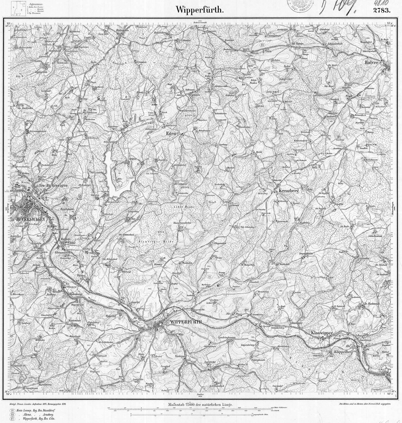
| TK25 (c) geogreif | 4810 (1894) |
| Jahr | Tag | Art | Bemerkung | Quelle |
|---|---|---|---|---|
| 1910 | 01.07.10 | PVneu | Inkeller | |
| 1930/39 | Umwandlung | Bf -> Bfu | AOE | |
| 1964 | 31.05.64 | PVstill |
| Strecke | km | |
|---|---|---|
| 2704 | Krebsöge - Anschlag | 14,6 |
| Baujahr | Abbruch | Nutzung | Bemerkung | Quelle | vorhanden | Bilder |
|---|---|---|---|---|---|---|
| 1910 | privat | Inkeller | ja | NRWbahnbilder |